Census Division No.7 - SARM Division No.3 - Saskatchewan
Rm of Victory No.226
The RM of Victory No. 226 lies in the Coteau Hills of west-central Saskatchewan, where the South Saskatchewan River widens into Lake Diefenbaker. It's home to the village of Beechy, the hamlet of Demaine, Prairie Lake Regional Park, and a share of the Matador Grasslands — one of the last large stretches of unbroken native prairie in the region.
History
Government surveyors ran their lines through this stretch of the Coteau Hills in the 1890s, but it wasn’t until the next decade that anyone came to stay. Ranchers arrived first, leasing tens of thousands of acres along the South Saskatchewan River to run cattle on the open range. Homesteaders followed close behind, and by the summer of 1908 a band of settlers had hauled their supplies west from Riverhurst, ferrying wagons across the river to found what became the community of Demaine.
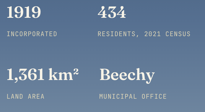
The families who followed broke the sod with teams of oxen and mules, long before a tractor ever crossed this ground. Grain took hold as the district's living, and as the population grew, two hubs emerged to serve the surrounding farms: the settlement that became the Village of Beechy, and the community that became the Organized Hamlet of Demaine. On December 8, 1919, the surrounding farmland was formally incorporated as the Rural Municipality of Victory No. 226, giving the district its own elected council and a name that, like many Saskatchewan RMs formed in the years after the First World War, honoured the Allied victory of 1918.
Beechy reached village status in 1925, once its population held steady above the 100 residents required — the story goes that a set of twins born to a local couple that year finally tipped the count. Electricity arrived the following year, and a string of grain companies set up elevators along the rail line over the following decades. Today the RM's economy still runs on the land its first settlers broke: grain farming across the open plain to the north, and cattle ranching on the rougher grassland close to the lake — much as it always has.
Beechy
Click Here for the Beechy Website
Pop. 209 (2021)Village status 1925
Beechy sits at the junction of Highways 342 and 737, tucked into the north-facing hills above a broad valley that drains southwest through Snakebite Coulee toward Lake Diefenbaker, about 18 km away. Rancher Robert Cruickshank is remembered as the district's first settler, having leased some 50,000 acres here around the turn of the century before the first furrows were ever ploughed around 1910.
As the village grew, it became the district's commercial anchor: grain buyers, a light plant that gave the village power from sundown to sun-up (with an extra shift on Monday mornings so residents could do their washing), and eventually the elevators that lined the rail siding. Most of those old wooden elevators are gone now, replaced in 2003 by the West Central Road and Rail terminal. Beechy today is where the RM keeps its municipal office and where much of the district's business still gets done.
The Matador Community Pasture
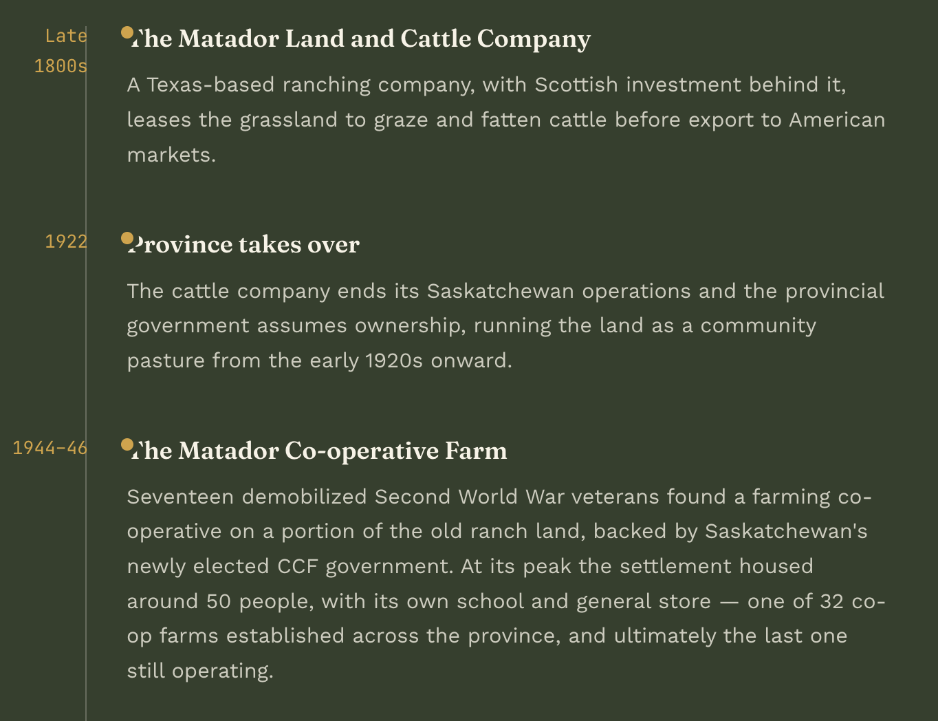
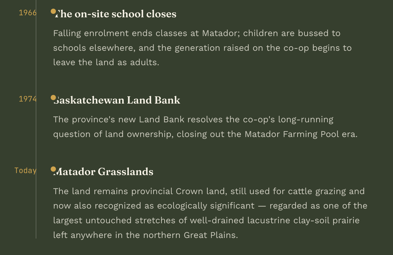
Southeast of Kyle, along the South Saskatchewan River, the Matador is one of Saskatchewan's most storied stretches of grass — Crown land that has passed from a Texas cattle empire to a postwar veterans' co-op to a provincial grazing commons, and now stands as one of the largest remaining tracts of untouched native prairie in the northern Great Plains.
Long before it belonged to the province, the Matador was the northern range of the Matador Land and Cattle Company, a ranching outfit headquartered in Matador, Texas with investors as far away as Scotland. From the late 1800s the company leased roughly 30,000 acres of Saskatchewan grassland to fatten American cattle — known in the trade as "beeves" — before shipping them south to market. That arrangement ended in 1922, when the company wound down its Canadian operations and the Saskatchewan government took over the land as a community pasture.
Prairie Lake Regional Park
About 21 km south of Beechy, where Cruikshank Bay cuts into the north shore of Lake Diefenbaker, Prairie Lake Regional Park has been the district's summer gathering place since it was established in 1984. The bay takes its name from the same Cruickshank family that first settled the Beechy district as ranchers decades earlier, and the park now sits over land that was open range before the Gardiner Dam backed the South Saskatchewan River up into the lake.
It's a working recreation site rather than a wilderness reserve: a full campground with electrified sites, showers and washrooms, and a sewer dump sits alongside a marina and boat launch that put visitors straight onto open water. A playground, picnic grounds, and a fish-cleaning station round out a park built for exactly the things people drive out to a prairie lake to do — swim, boat, fish, and camp under an open sky.
Demaine
Pop. ~20 (2021)Settled July 1908
Demaine takes its name from the Demaine family among the district's earliest settlers — E. J. Demaine went on to serve as the community's first postmaster, a post he held from the opening of its post office in 1910 until 1932. It was founded by a group of settlers who hauled their supplies overland from Riverhurst and across the South Saskatchewan River in the summer of 1908, before any bridge or reliable crossing existed.
Sitting just east of Beechy at the junction of Highway 342 and Grid Road 737, Demaine remains a small farming community and a close neighbour to both Prairie Lake Regional Park and Lake Diefenbaker. It's one of well over a hundred organized hamlets across rural Saskatchewan — small enough to have no formal municipal government of its own, but represented by a resident hamlet board that advises the RM council on local needs.